


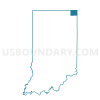
JACKSON, Steuben County, Indiana
About
Outline

Summary
| Unique Area Identifier | 580668 |
| Name | JACKSON |
| County | Steuben County |
| State | Indiana |
| Area (square miles) | 35.00 |
| Land Area (square miles) | 33.94 |
| Water Area (square miles) | 1.05 |
| % of Land Area | 96.99 |
| % of Water Area | 3.01 |
| Latitude of the Internal Point | 41.65749940 |
| Longtitude of the Internal Point | -85.14539620 |
Maps


Graphs
Select a template below for downloading or customizing gragh for JACKSON, Steuben County, Indiana


Neighbors
Neighoring Voting District (by Name) Neighboring Voting District on the Map
- GREENFIELD TOWNSHIP, LaGrange County, IN
- JAMESTOWN 02, Steuben County, IN
- MILFORD EAST, LaGrange County, IN
- MILLGROVE, Steuben County, IN
- PLEASANT 05, Steuben County, IN
- PLEASANT 07, Steuben County, IN
- SALEM, Steuben County, IN
- SPRINGFIELD TOWNSHIP, LaGrange County, IN
- STEUBEN, Steuben County, IN
Top 10 Neighboring County Subdivision (by Population) Neighboring County Subdivision on the Map
- Pleasant township, Steuben County, IN (13,704)
- Jamestown township, Steuben County, IN (3,249)
- Milford township, LaGrange County, IN (2,868)
- Steuben township, Steuben County, IN (2,835)
- Salem township, Steuben County, IN (2,262)
- Jackson township, Steuben County, IN (1,777)
- Millgrove township, Steuben County, IN (1,577)
- Greenfield township, LaGrange County, IN (1,276)
- Springfield township, LaGrange County, IN (1,179)
Top 10 Neighboring Unified School District (by Population) Neighboring Unified School District on the Map
- Steuben County Metropolitan School District, IN (18,053)
- Lakeland School Corporation, IN (14,692)
- Prairie Heights Community School Corporation, IN (9,663)
- Fremont Community Schools, IN (7,041)
Top 10 Neighboring State Legislative District Lower Chamber (by Population) Neighboring State Legislative District Lower Chamber on the Map
Top 10 Neighboring State Legislative District Upper Chamber (by Population) Neighboring State Legislative District Upper Chamber on the Map
Top 10 Neighboring 111th Congressional District (by Population) Neighboring 111th Congressional District on the Map
Top 10 Neighboring Census Tract (by Population) Neighboring Census Tract on the Map
- Census Tract 9701, LaGrange County, IN (6,324)
- Census Tract 9710, Steuben County, IN (3,809)
- Census Tract 9715, Steuben County, IN (3,593)
- Census Tract 9707, LaGrange County, IN (2,991)
Top 10 Neighboring 5-Digit ZIP Code Tabulation Area (by Population) Neighboring 5-Digit ZIP Code Tabulation Area on the Map
- 46703, IN (18,029)
- 46761, IN (12,039)
- 46746, IN (4,036)
- 46747, IN (2,693)
- 46779, IN (2,166)
- 46776, IN (1,484)